Three Storms to Watch in the Atlantic

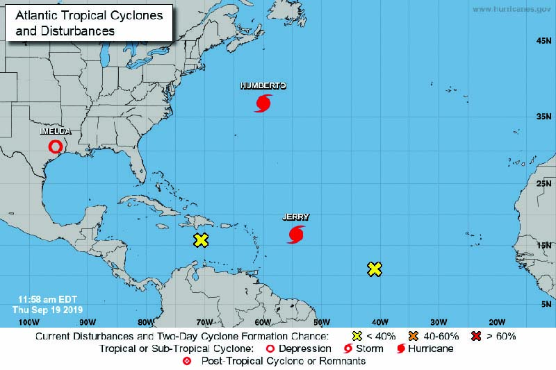
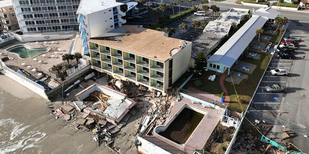
UNITED STATES—September 19, 2019—As we move through the peak weeks of the Atlantic hurricane season, forecasters are tracking three storms: Humberto, Imelda, and Jerry. Hurricane Humberto, a Category 3 storm and the Atlantic’s second major hurricane of the season, passed about 75 miles north of Bermuda late Wednesday night, according to CNN. With sustained wind speeds of 120 mph at its core, the storm’s hurricane-force winds extended out 80 miles, lashing Bermuda and plunging 80% of the island into darkness. Strong winds will continue to impact the island through Thursday morning.
Parts of Bermuda are also under a flood watch due to storm surge, waves over 30 feet, and up to 6 inches of rain. Heavy rain and increasingly large swells are expected through the day on Thursday with the waves affecting Bermuda as well as the northwestern Bahamas and southeastern U.S. coast from Florida to North Carolina, according to CNN. The National Hurricane Center warned that these swells could cause life-threatening rip currents.
Tropical Storm Imelda made landfall over southeast Texas before weakening to a tropical depression, but with the storm expected to bring more than a foot of rain this week, officials are warning of possible life-threatening flash floods, according to USA Today. The National Weather Service forecasts an additional 5 to 10 inches of rain from the upper Texas coast into southeast Texas, with isolated storm totals of 25 to 35 inches. Impacted cities could include Beaumont, Houston, Galveston, Matagorda, Victoria, and Corpus Christi.
The forecast also predicts Imelda could dump as much as 10 inches of rain on portions of Louisiana and up to 8 inches in other parts of Texas. In addition to flooding, Imelda brings sustained winds of 30 mph and gusty thunderstorms which could produce a waterspout or tornado, according to USA Today.
A third named cyclone, Jerry, strengthened into the Atlantic’s fourth hurricane early Thursday with maximum sustained winds of 75 mph, according to the Miami Herald. Hurricane Jerry is currently east of the Leeward Islands and is expected to carve a path through the Caribbean before turning northeast and heading out to sea. Although no landfall is currently expected in the Caribbean, the Miami Herald reports that tropical storm watches are in effect for St. Maarten, St. Martin, Barbuda, Anguilla, St. Barthelemy, Saba, and St. Eustatius. These islands could see several inches of rain, high winds, and rip currents as Jerry passes.
Although the current forecast shows minimal effects on land, the Miami Herald reports that the five-day “cone of concern” as Hurricane Jerry turns out to sea now includes Bermuda, which was just impacted by Category 3 Hurricane Humberto. Bermuda, which due to being such a small target out is rarely affected by hurricanes, has seen just 21 hurricanes come within 100 miles in the last 100 years, according to CNN. Hurricane Jerry’s path five days out is still largely uncertain, but with the possibility that a second cyclone in a week could impact Bermuda, Hurricane Jerry is a storm to watch.


