Headed Into the Peak of Hurricane Season, NOAA Tracks Two Systems

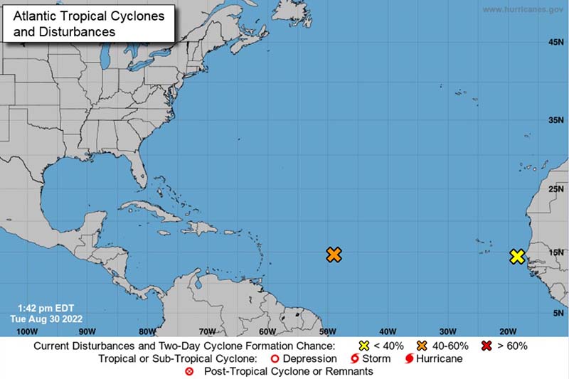
FLORIDA—August 30, 2022—As of Tuesday morning, the National Oceanic and Atmospheric Association is tracking two systems in the Atlantic with the potential to form tropical cyclones as we move into the peak of hurricane season. The first system is an area of low pressure east of the Lesser Antilles that is producing a large area of showers and thunderstorms with an 80% chance of cyclone formation over the next five days, according to NOAA.
The second system is a tropical wave and low-pressure area forming off the west coast of Africa. NOAA forecasts possible gradual development as the system tracks across the Atlantic, bringing heavy rain to the Cabo Verde Islands midweek. However, this system currently has only a 40% chance of cyclone development through five days.
The Atlantic hurricane season has been relatively quiet so far with just three named storms to date. Still, residents of coastal areas and restoration professionals alike would be wise to remain vigilant and maintain storm season preparedness. The peak of hurricane season runs from mid-August to mid-October, with September typically being an active month. Despite the season’s slow start, the NOAA is still predicting an above-average year, with a forecast of 14-21 named storms according to the Orlando Sentinel. If accurate, that would mean restoration professionals must be prepared for an especially busy fall.


