Double Tropical Storms Aim Toward Louisiana

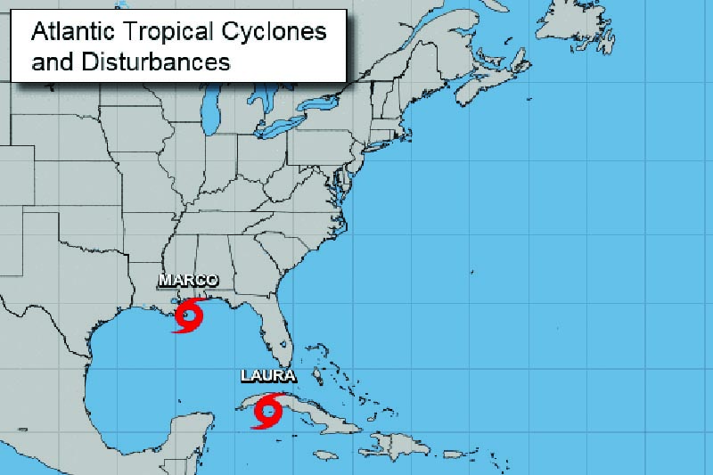
LOUISIANA—August 24, 2020—Hurricane Marco weakened to a tropical storm early Monday as it churned toward Louisiana, further weakening as it approaches the coast. Tropical Storm Marco is now expected to make landfall in Louisiana Monday evening with 40 mph winds and heavy rain, according to NPR. While Marco’s weakening has eased some of the worst fears, Louisiana is still bracing for impacts from two major tropical storms in just 48 hours. Tropical Storm Laura is expected to strengthen to a hurricane as it enters the Gulf of Mexico early Tuesday, with forecasters predicting it will make landfall as a Category 2 storm near the Texas-Louisiana border late Wednesday night.
The most concerning impacts from the double punch of storms will be flooding from rainfall and storm surge. Marco has already drenched some areas along the Gulf Coast with 8 to 9 inches of rain, according to NPR. Laura following directly behind is expected to produce 4 to 8 inches of rain with some areas seeing up to 12 inches by late this week. Forecasters say this will likely cause widespread flash flooding with Laura’s winds expected to cause additional damage and power outages. NPR reports Louisiana Gov. John Bel Edwards warned residents that the narrow window between the two storms means rescue efforts will be limited until after Laura has passed, and residents should be prepared to shelter in place for 72 hours.
Further complicating rescue efforts is the COVID-19 pandemic, which has hit both Texas and Louisiana hard in recent weeks. Louisiana Gov. Edwards is encouraging residents to wear masks and physically distance as much as possible, according to NPR. State officials don’t expect to need mass shelters unless Laura becomes a Category 3 storm, but if needed, they are preparing to perform health screenings, provide PPE, and physically distance between family unit


